Showcase
- NZILA Award of Excellence Resource Management and Strategic Planning — 2022
The Napier Landscape Study (‘the Study’) was carried out to inform the Napier’s District Plan Review. It’s intended audiences were the officers preparing the Draft District Plan and Napier’s public.
Qualities that set the Study apart are the clarity with which it presents landscape concepts and the vividness with which demonstrates those concepts in practice. It demonstrates integration of tangata whenua perspectives alongside western perspectives, the integration of associative aspects, and the application of a landscape approach to both rural and urban settings.
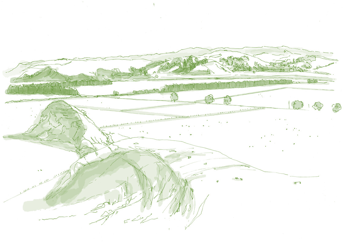
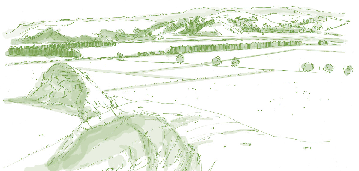
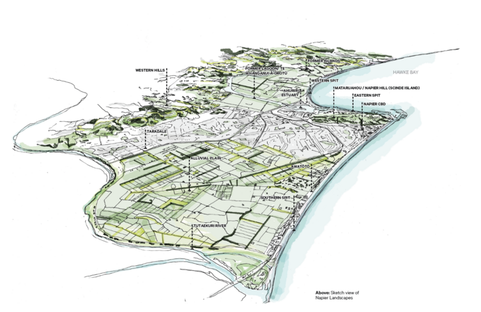
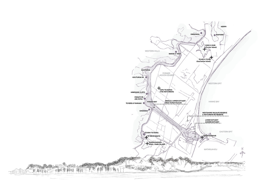
At first glance, Napier does not meet conventional notions of landscape significance. It is largely urbanised, flat, and backdropped by modest hills. Yet Napier has an extraordinary ‘sense of place’. The Study demonstrates the landscape characteristics that underpin such sense of place and that are valued by people in often ordinary landscapes. It highlights characteristics and qualities that might otherwise be overlooked by a more conventional approach.
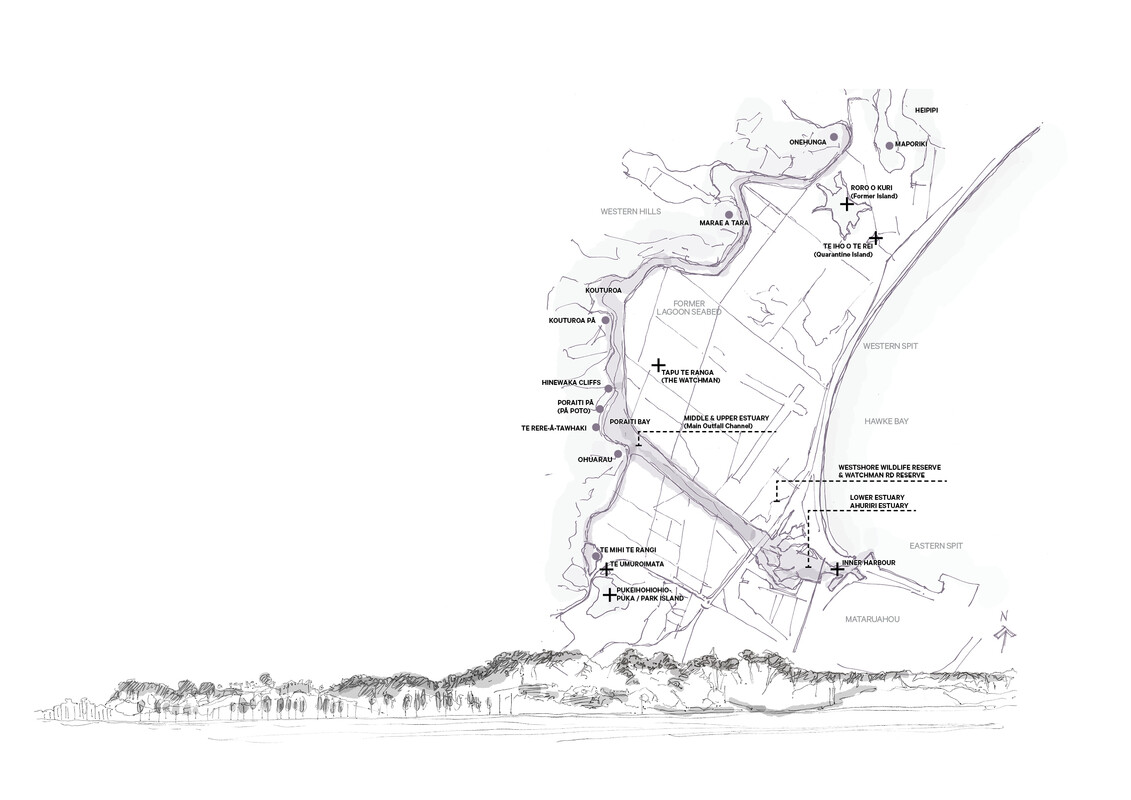
The intangible and associative aspects are especially important in Napier because of the pervasive influence of the 1931 earthquake. Values are associated with not only the character of the new landscape and rebuilt city, but the landscape associated with the former lagoon Te Whanganui ā Orotū.
The Napier Landscape Study, therefore, is a benchmark example of the evolving sophistication of landscape assessment approaches as described in the recently adopted ‘Te Tangi a te Manu: Aotearoa New Zealand Landscape Assessment Guidelines.
Judges’ Citation:
The Napier Landscape Study demonstrates an approach to this kind of work that pushes the boundaries.The study has encouraged the client into doing something unexpected and going beyond the brief. The outcome is a very accessible and engaging study, which is clearly landscape-led and addressing a technical landscape topic. However, it goes beyond this technical requirement and makes the landscape more broadly understandable for the wider public and, importantly, decision makers, policy planners and elected representatives.
It is a timely example of a landscape-led approach to spatial planning (in the context of upcoming RMA reforms) under Te Tangi a te Manu, with loose graphics helpful in telling and documenting the landscape story in an easily understood publication. It takes landscape analysis beyond GIS mapping into a realm that eloquently paints a picture of Napier’s sense of place, as experienced by locals and visitors. The project demonstrates the way design communication incorporating a diverse range of media is a critical tool in articulating landscape values.
Client:
Napier City Council
Company:
Isthmus
Internal Collaborators:
Te Taiwhenua O Te Whanganui Ā Orotū, through Tania Eden. The Study also draws on parallel studies listed in the nomination with respect to natural and ecological values, heritage, and places of significance to Māori
External collaborators:
Te Taiwhenua ō Te Whanganui ā Orotū and Napier City Council
All images